


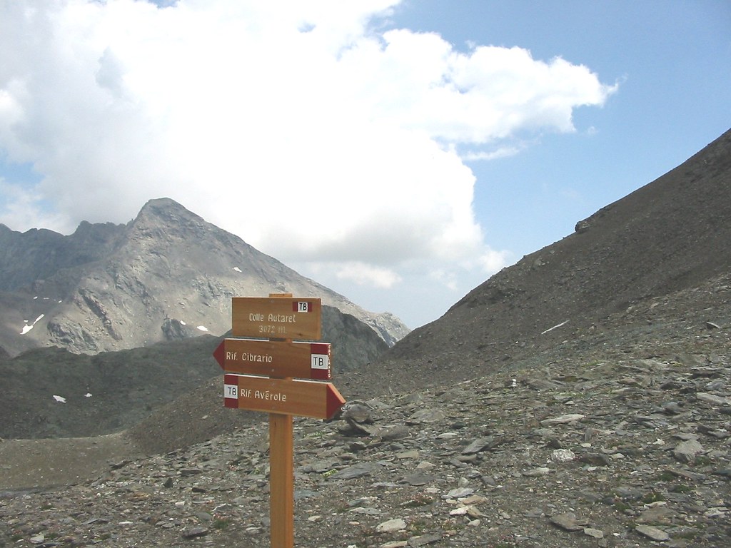

Refuge Cibrario
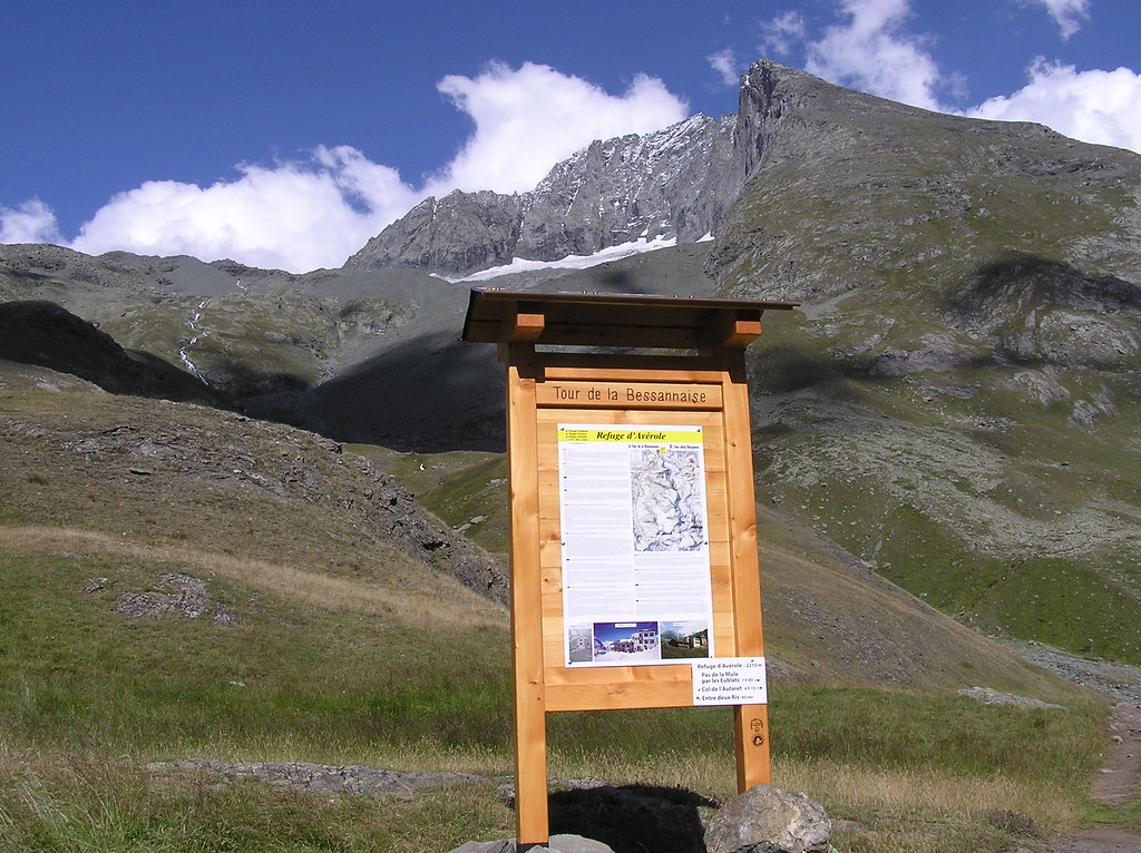
Sulè Pass, Autaret Pass, Lombarda Valley, Refuge Avérole
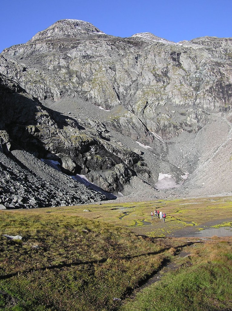
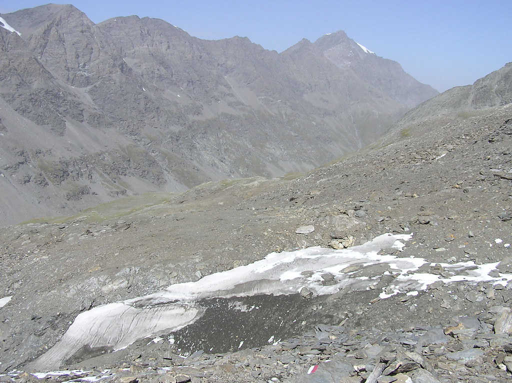
From Rifugio Cibrario cross the Pian del Sabiunin flat westward, reaching for the moraine. Here a steep slope starts climbing southwards the 300 m. rise leading to a glacial basin. This is the relict of the previous Berta’ glacier (2900 m.), now a simple moraine crossed by little snowfields.
Now the slope is very light, and the plain may be crossed keeping close to the rock cliff descending from mount Testa Sula. A few turns of the path directly lead to Col Sule’ pass (3073 m). From here you can easily see the triangular shape of Point Costan, the Col de l’Autaret pass (this is our next destination) on its right side, and the small valley collecting waters coming from the eastern Autaret lakes. The second part of our treck takes place in this little gully.
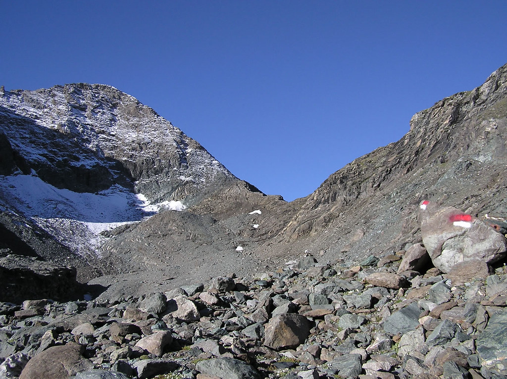
From the Col Sule’ pass the path goes down a steep debris slope for an approximate 100 m, then the slope becomes smoother and a stony ground leads to an altitude of about 2800 m where, near e clearly visible boulder, we leave the
Costan Peak (3305 m) with the Autaret Pass (3071 m) path leading down to Colle Spiol and go up again (look for an sign pole) for about 30 m towards a small pass behind which is a snow-melting pool.
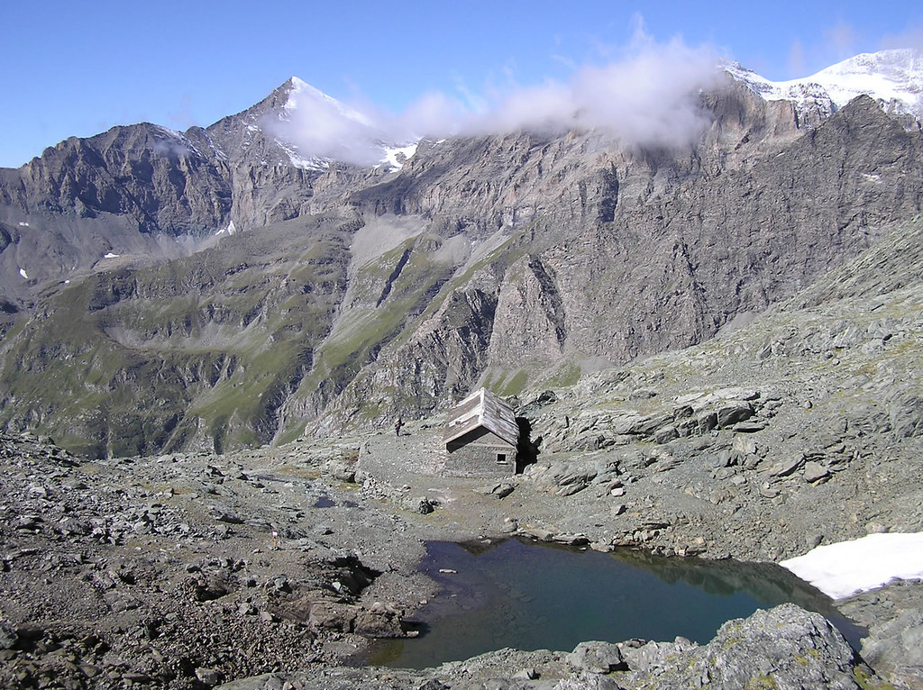
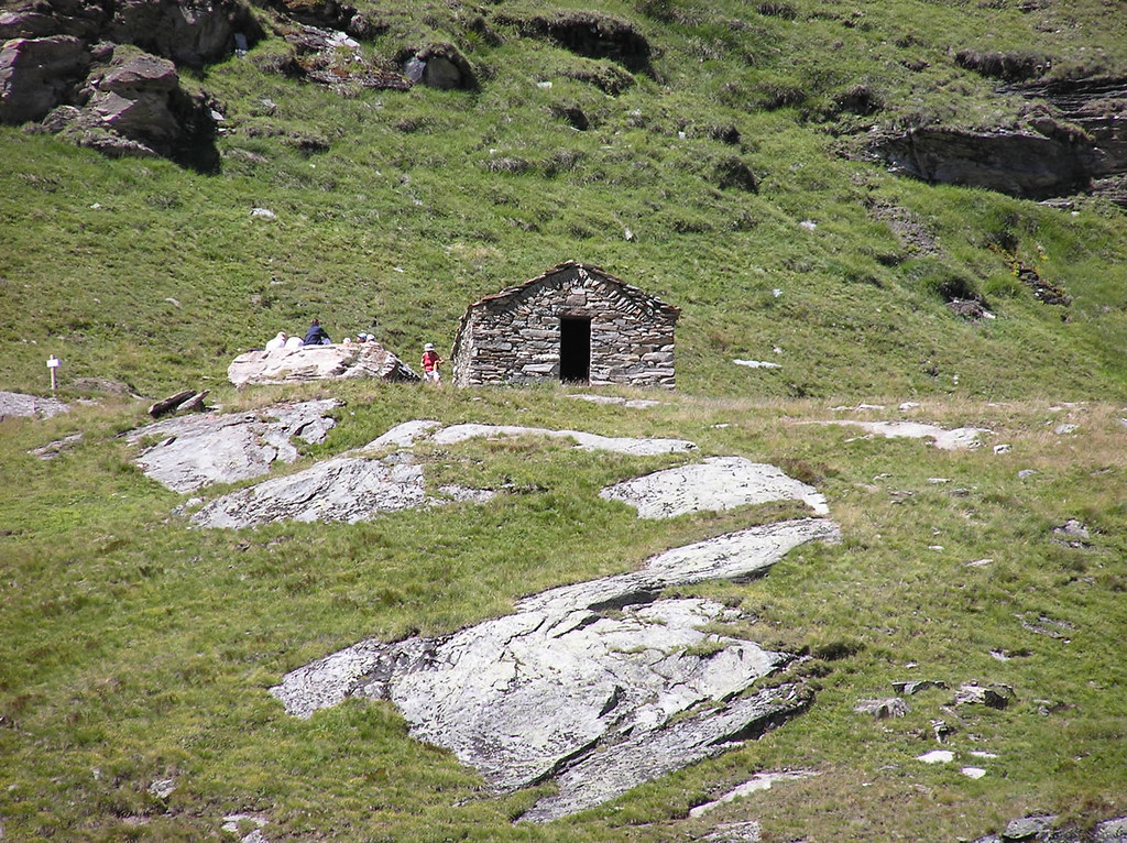
Pass the pool keeping on its left side, then go westward on a grassy ground, then look for path tracks leading south to a well-marked and visible stone-paved track. Take this track always going westward up to a hill from which you will a small lake and an old custom barrack which served as a refuge in the past Rifugio Moise.
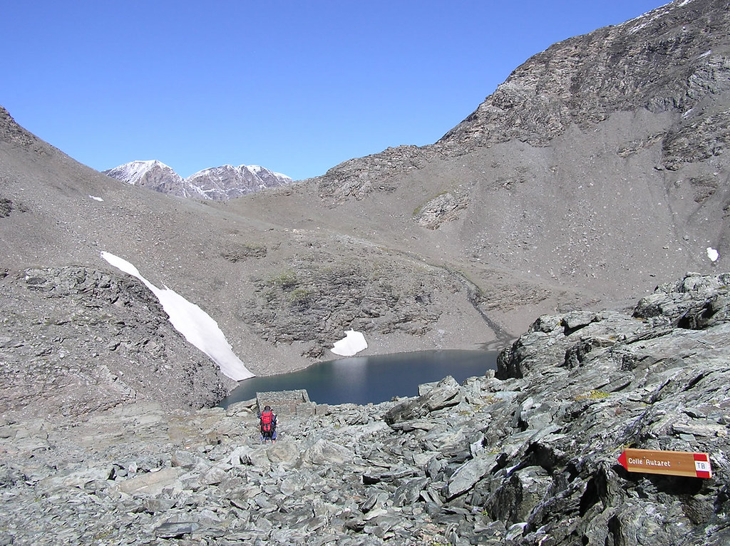
From behind the barrack a well signed track leads to the the east lakes. Continue on this track, and after having passed the lakes the path crosses another track coming from Malciaussia, just over the creek coming out of the West Autaret Lake.
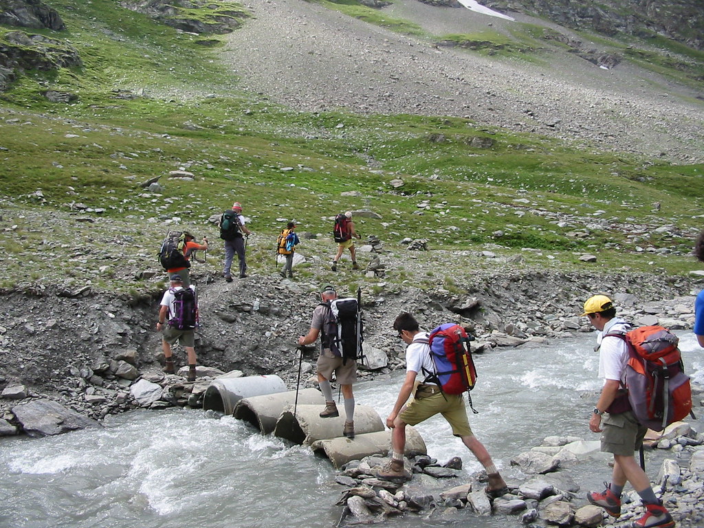
Proceed on the debris ground reaching for the Col De L’Autaret (3072 m), signed by a Cross. From the Pass go down the steep maraine fron heading North, then proceed on a constant slope coming to cross a stream (Torrent de la Lombard), which can be crossed using big concrete pipes laid down for this purpose (2530 m).
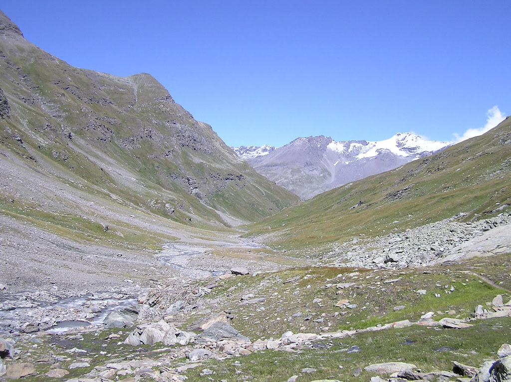
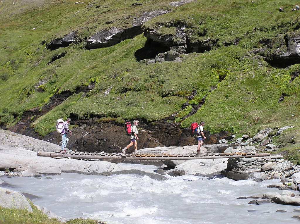
Walk the left bank following the stream down to an altitude of 2450 m, little before you reach a shepherds hut (Cabane des Bergeres), the track turns right leaving the main path to go down to a wooden footbridge leading you again on the right bank of the stream. After the footbridge the track goes slightly up to the Mule Pass.
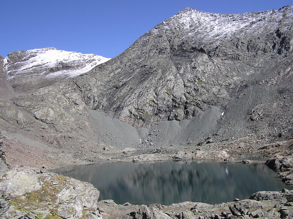
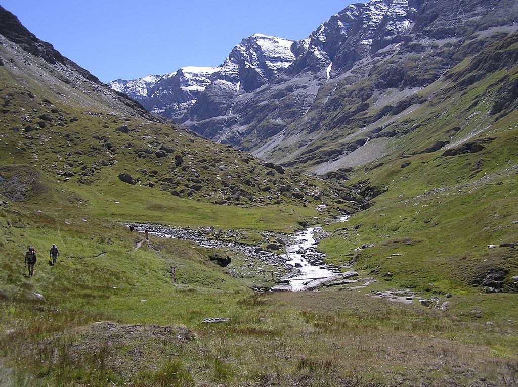
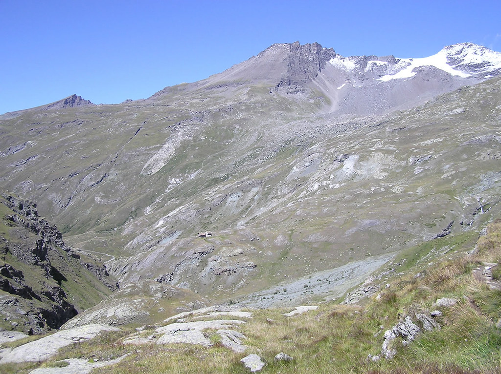
From here it goes down again towards the Plan de Revallon plain, where the Refuge d’Averole is already visible. One of Autaret lake (2960 m)
The Refuge is quickly reached in a few minutes, climbing the slope and following left the last meters of the track coming from Col d’Arnas.


